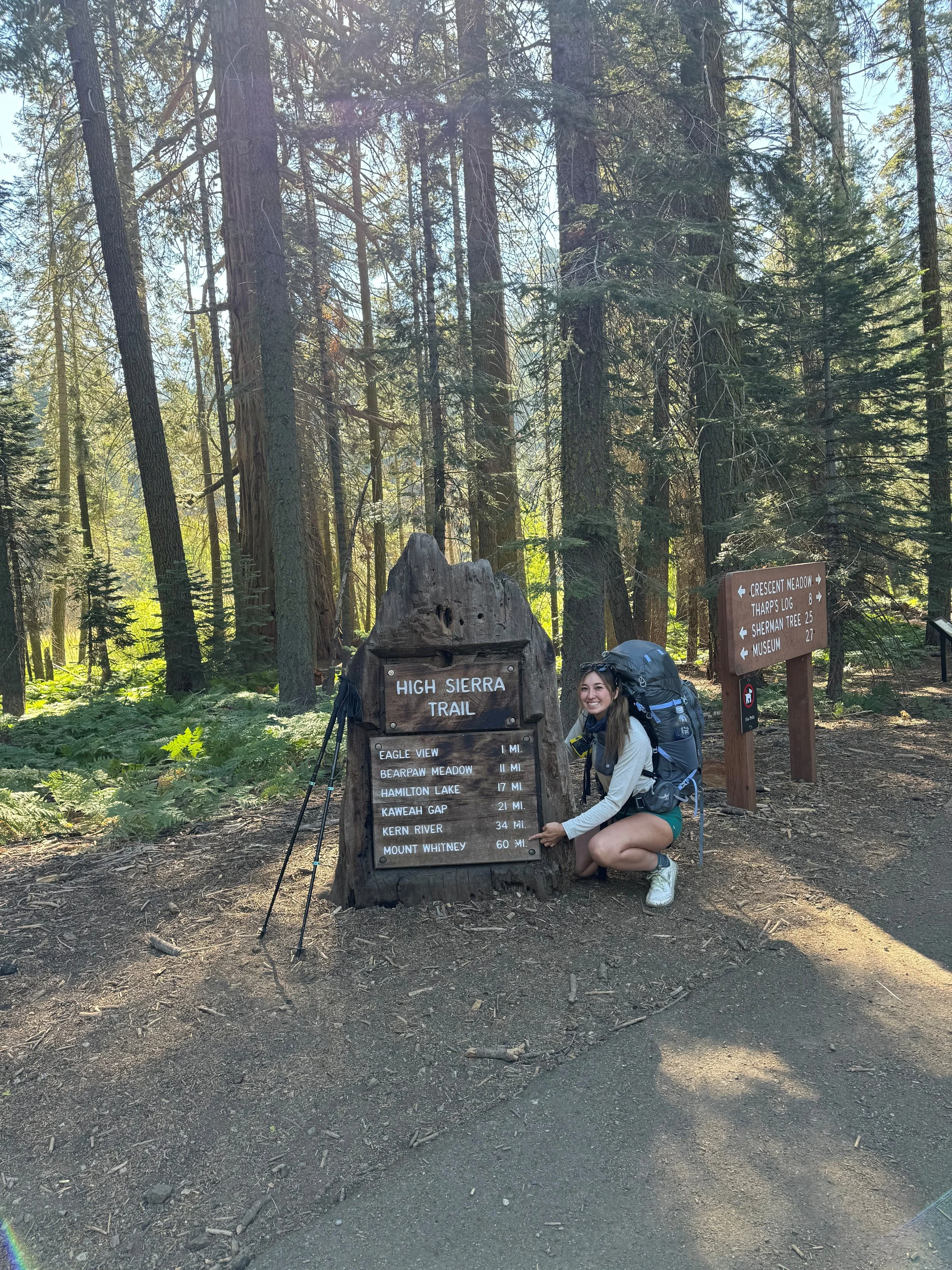
How to Thru‑Hike the High Sierra Trail (Crescent Meadow → Whitney Portal)
GAIA GPS
The High Sierra Trail is an unforgettable 60 ish-mile adventure that takes you deep into the heart of Sequoia National Park, starting from the lush, meadow-filled trails of Crescent Meadow and leading all the way to the summit of Mt. Whitney - the tallest peak in the lower 48 states at a jaw-dropping 14,505 feet!
Unlike the busier and often longer John Muir Trail, the High Sierra Trail was purposefully crafted as a more direct west-to-east crossing of the Great Western Divide. This iconic route offers backpackers a slightly less traveled, yet equally stunning, path through some of the most breathtaking alpine landscapes in California.
Quick Facts
Distance - ~72.2 mi (Crescent Meadow to Whitney Portal)
Elevation Gain / Loss - ~+15,000 ft, −13,500 ft
Difficulty - Strenuous (high altitude, steep ascents, creek crossings)
Typical Duration - 5–9 days eastbound
Camps with Bear Boxes & Pit Toilets - Bearpaw, Hamilton Lake, Big Arroyo, Moraine Lake, Webb (Junction), Wallace Creek, Crabtree, Guitar Lake
Why Go Eastbound?
Permits easier to get: Crescent Meadow HST permits are issued online (~70% held through Recreation.gov six months ahead, release at 7 a.m. PT), while Whitney Portal permits are tied into the tough Mount Whitney lottery system.
Better acclimatization: You start at ~6,500 ft and slowly gain altitude, reaching Mt. Whitney (14,505 ft) only on your final day.
Dramatic finale at the summit, then descent to Whitney Portal → Lone Pine.
Your Day-by-Day Route (Eastbound)
| Date | Segment | Distance (mi) | Elevation Gain | Camp Elevation | Notes |
|---|---|---|---|---|---|
| 1 | Crescent Meadow → Bearpaw Meadow | ~11.4 | ~1500 | Bearpaw Meadow (7,800 ft) | Trail begins on a forested path before opening up to granite cliff edges. Lots of water sources and wildlife sightings along the trail. Keep a look out for bear. |
| 2 | Bearpaw → Hamilton Lake (no side-trip to Big Arroyo) | ~5.2 | ~2200 | Hamilton Lake (10,300 ft) | Hamilton Lake is a must stop location along this trail. Pit toilets & bear box available just above the lake; amazing trout fishing and swimming opportunities. |
| 3 | Hamilton Lake → Moraine Lake (via Kaweah Gap) | ~13.4 | ~3600 | Moraine Lake (~11,000 ft) | Make sure to check out Precipice en route, even late into summer there is surely still ice on the lake. Start this day early to beat the heat and exposure on Kaweah Gap. |
| 4 | Moraine Lake → Wallace Creek / JMT junction | ~18.9 | ~2400 | Wallace Creek (~10,500 ft) or nearby | Snake through Big Arroyo → Chagoopa Plateau → Kern River (stop to soak in the hot spring); camp near Wallace Creek jct for JMT access. |
| 5 | Wallace Creek → Guitar Lake | ~6.8 | ~1600 | Guitar Lake (~11,600 ft) | Gentle climb past Crabtree Ranger Station; pit toilet is available at Crabtree. A morning start helps beat afternoon storms. |
| 6 | Guitar Lake → Mt. Whitney → Lone Pine start descent | ~13.7 | ~3000ft up + ~5100 ft down | Summit + descend to trailhead | Wag‑bag required above Crabtree Meadow, bear canister required through Whitney zone. Get an early start to make it to summit by sunrise. |
Try AllTrails
Download offline maps, preview trails in 3D, access National Park guides and more!
Best Season to Hike the High Sierra Trail
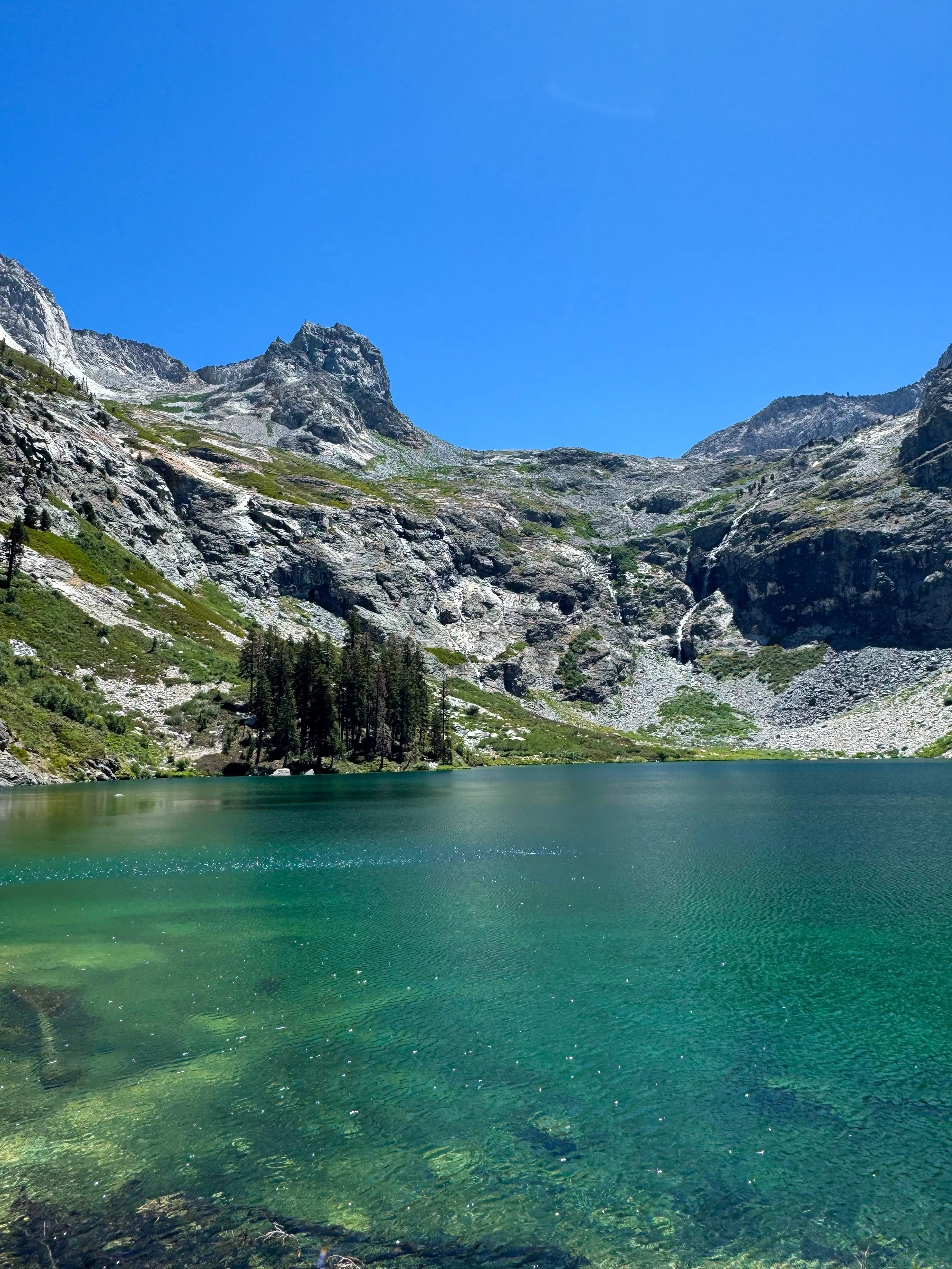
Hamilton Lake
The prime time to take on the High Sierra Trail is typically July through early September, when most of the snow has melted, creek crossings are safer, and the high passes are fully accessible. Early in the season, lingering snow can make certain sections—especially the narrow cliffside paths—dangerous without proper gear and experience. Late fall, on the other hand, brings the risk of sudden snowstorms and icy conditions.
I hiked the trail during the first week of August, and it was absolutely perfect—warm but never scorching, cool nights that weren’t freezing, and just one light sprinkle of rain on the second-to-last day. That said, Sierra weather is notoriously unpredictable, and conditions can shift quickly, so always be prepared for everything from blazing sun to sudden storms.
Permit & Logistics Checklist
Wilderness permit — required if camping anywhere in Sequoia/Kings Canyon; quota season in 2025 runs May 23 – September 27 (30–40 spots per day)
Permit pickup — at Lodgepole Visitor Center, either the day before after 1 p.m. or by 10 a.m. on your start date; permits held after 9 a.m. may be redistributed to walk-ups.
Mount Whitney permit (day/overnight) — only needed to summit, but subject to separate lottery or walk‑up → best to exit at Trail Crest/Whitney Zone via JMT to avoid that hassle
Transportation:
Leave car in Visalia and take the Sequoia Shuttle ( around $7-15 one way ) , then grab the FREE Sequoia NP Visitor Transit → Crescent Meadow
Exit from Whitney Portal → hitch (common and relatively safe).
I’m not going to bash a particular company (even though I probably should), but we did reserve a shuttle from Lone Pine to Fresno and it was probably one of the worst shuttle experiences in my life. I do not recommend.
What we did - My group flew into Fresno Airport and rented a car from Enterprise. We drove to Visalia were we stayed in an airbnb for a few days pre-trip to explore the area. We used the extra day to drive up to Lodgepole Visitor Center and grab our permits the day before our hike and to check out the Park. ( it’s a bit of a long drive so be prepared to spend a few hours getting there ).
We pre-booked the Sequioa Shuttle from Visalia Convention Center to the Giant Forest Museum for the following day- which is a block away from the Enterprise Drop off location. We walked to the bus stop and hopped on. The bus was fantastic; the drivers are wonderful and fun. I can’t recommend this process enough.
Once we arrived at Giant Forest Museum - we were right on time to hop onto the Route 2 shuttle to Crescent Meadow to begin our hike ( if you happen to miss one, don’t fret, they arrive every 15-20 minutes).
Hurray! You will have made it to Crescent Meadows Trail head to begin your adventure.
Permit Process
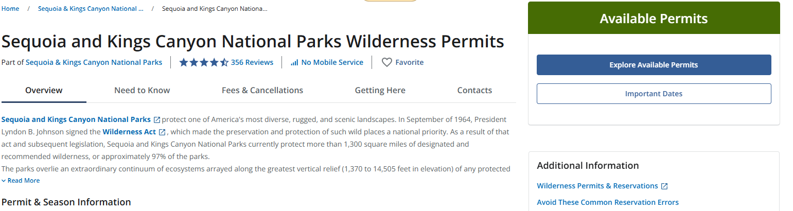
What you should search on Recreation.gov for correct permits
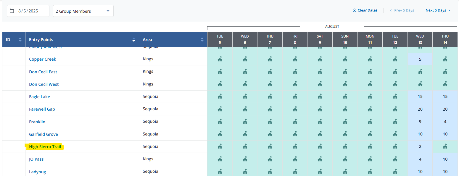
After Selecting “Explore Available Permits” You will have the option to select you date, group size and for the High Sierra Trail ( this permit gives you access to Summit Mt. Whitney.
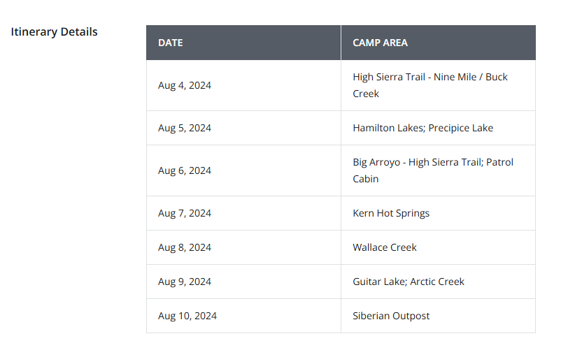
Once your Start Date has been selected, you will be prompted to select an Itinerary ( Don’t worry too much about this, it’s just a rough outline of your schedule. It is not required to stay at these campsites or abide by the dates you pre-selected). We changed up our sites after realizing we had the energy to put in more miles. Our group finished a whole day early.
Gear Requirments
Bear canister required on the entire HST; most camps have bear boxes where you can stash it (e.g. Bearpaw, Hamilton, Moraine, Wallace, Crabtree)
Wag bags required from Crabtree Junction (JMT) through Whitney Portal ↓ pack out solid waste per Mt. Whitney zone rules. The ranger at Lodgepole gave us ours when we picked up the permits, however this is not guaranteed.
Read my Full Backpacking Check list Blog!
Highlights You’ll Pass
Giant sequoias inside the first few miles near Crescent Meadow
Granite tunnels blasted through rock near Alta Meadow and Hamilton Creek
Panoramic edge day at Kaweah Gap (~10,700 ft) – spectacular views looking west and east
Moraine Lake – often frozen into July, a serene alternative campsite off the main route
Large alpine meadows at Big Arroyo, Junction Meadow, Wallace Creek — lots of great fishing opportunities
Guitar Lake at sunset – humming of military flights, dramatic silhouette of Mt. Whitney (it is common!)
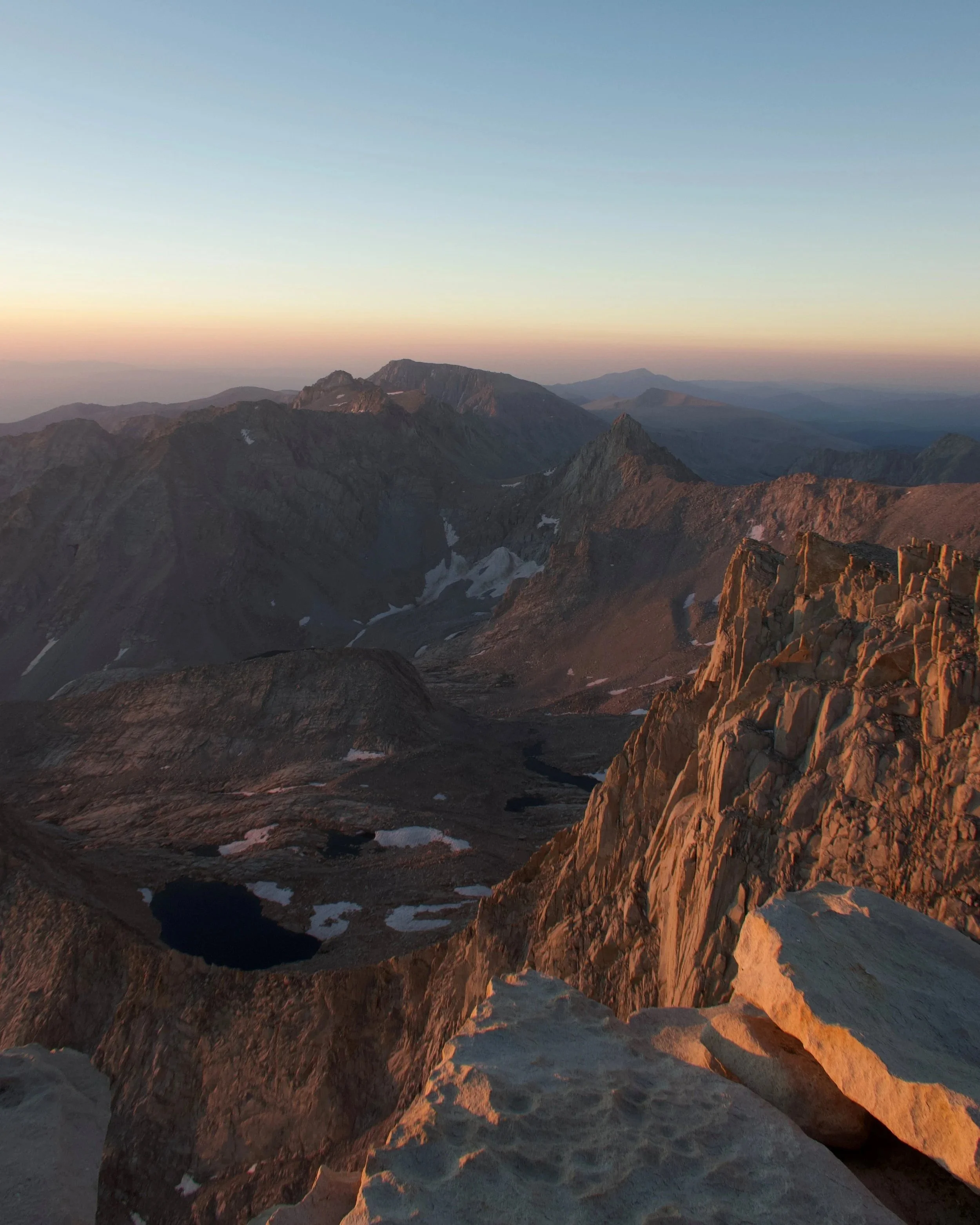
Sunrise summit of Mt. Whitney (14,505 ft) — endless horizon from the summit!
Trail Gallery